Phil Konstantin's Panorama Photographs - Page 3
New Mexico - Oklahoma - Oregon - Texas - Utah #1
I love to take photographs. Over the years (I've had a website since 1996), I have literally posted tens of thousands of my photos online. I also enjoy merging individual photos into panoramas. Long before the internet and digital photography, I used to do this. My living room has several large groups of photos which were literally "cut and pasted" together to form one long photo. Digitally, some of these conversions have worked well, some have not. I have used a variety of software to construct my panoramas: including PhotoImpact, Photoshop and a variety of stand alone Panorama software. Currently, I am in the process of finding all of my panoramas and posting them on one, all-inclusive, website (this one). Roughly, the photos are sorted alphabetically, by US state, then country (Guatemala and Mexico), and finally, San Diego California.
Each group below will have the individual photos on the left, and the panoramic photos I made from them on the right.
Click on any of the pictures (individuals or panoramas) to see a MUCH LARGER version of it.
New Mexico |
New Mexico |


3 photo panorama |
 Chaco Canyon - New Mexico - Possibly taken in 1992 I really enjoyed my trip here. When I visited, you had to drive over 20 (+/-) miles of washboard roads. It was still worth it. There are many different ruins in the park. Pueblo Bonita is amazing. The structure was originally, at least, 4 stories high. Click here to see the rest of the photos of this area |


2 photo panorama |
 Anthony, New Mexico and Vinton, Texas - 10:19am, March 14, 2012 |


2 photo panorama |
 I think this is New Mexico - 2009 2.0 mb photo |
Oklahoma |
Oklahoma |


4 photo panorama |
 Cherokee Nation-owned Hard Rock Hotel and Casino near Tulsa, Oklahoma - April 12, 2013 |


7 photo panorama |
 View from the Cherokee Nation-owned Hard Rock Hotel and Casino near Tulsa, Oklahoma - April 12, 2013 |
Oregon |
Oregon |

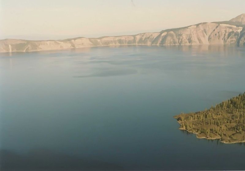


4 photo panorama |
 Crater Lake - Oregon - 1988 It is a beautiful shade of blue. It sits in the remnants of an ancient volcano which erupted and blew of its top, much like Mt. St. Helens. The lake is very deep. Wizard Island was created by a later, less violent, eruption. Click here to see the rest of the photos of this area |
Texas |
Texas |


6 photo panorama |
 Junction of the Pecos River and the Rio Grande. Texas is at the bottom and Mexico at the top - October 14, 2012 |


3 photo panorama |
 Sanderson, Texas - October 14, 2012 |


4 photo panorama |
 Approximately 40 miles east of Alpine Texas - 7:33am, October 14, 2012 |


3 photo panorama |
 Van Horn, Texas #1 from 35,000 feet - 7:50am, October 14, 2012 The paved sections of the runway are about 1 mile long. |


4 photo panorama |
 Van Horn, Texas #2 from 35,000 feet - 7:52am, October 14, 2012 |


3 photo panorama |
 Pasadena, Texas Public Library Plaque (note my name!) - 8:39am, April 2, 2013 |


5 photo panorama |
 Pasadena, Texas Public Library - 8:39am, April 2, 2013 |
Utah #1 |
Utah #1 |


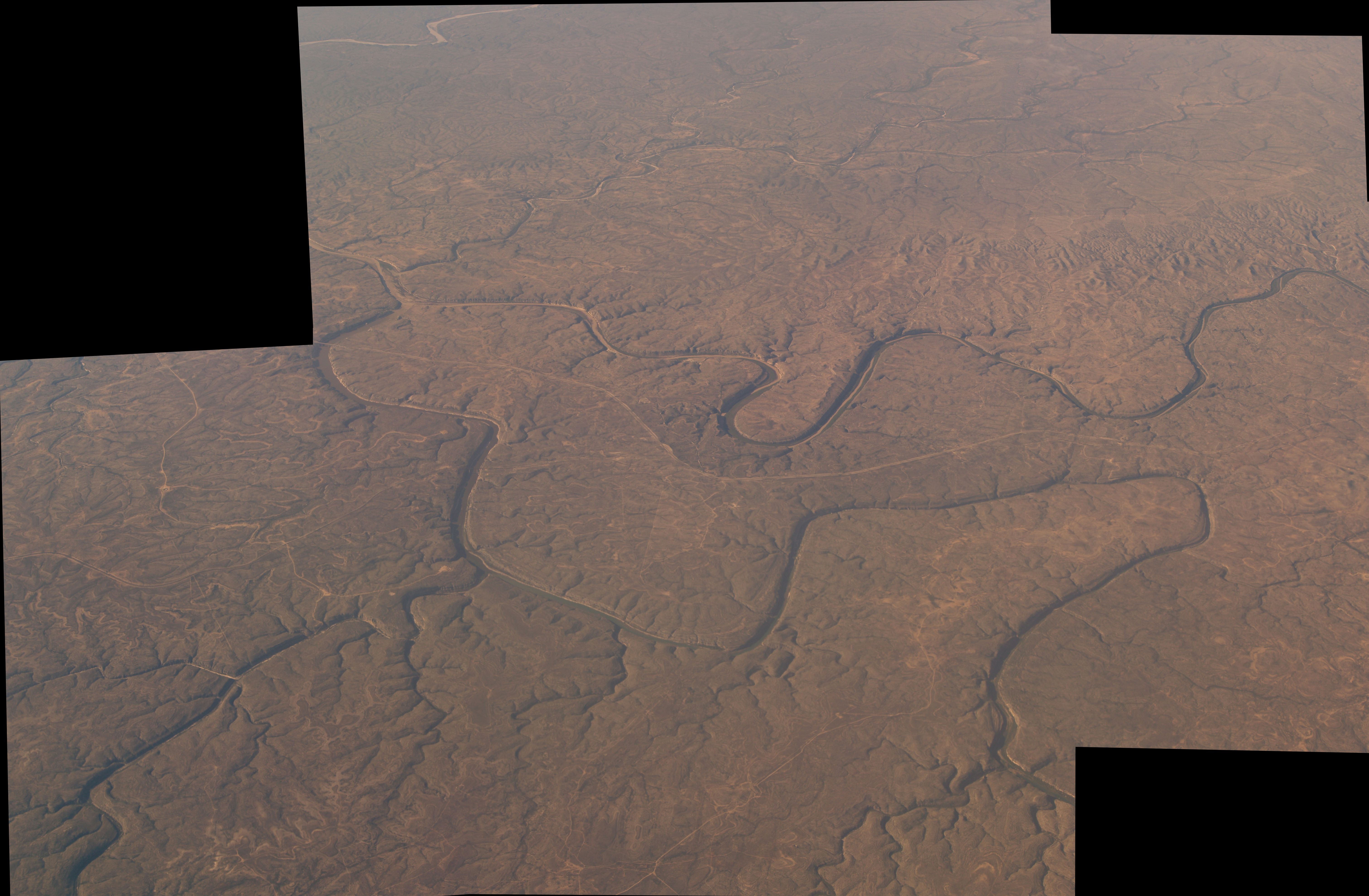
Photos 42315556 through 4231558 on April 22, 2006. |
 137kb panorama  4.9mb panorama 3 photo panorama of the Goosenecks of the San Juan River in Utah on April 22, 2006. In this one mile stretch, the river actually travels over five miles. The canyon is approximately 1,000 feet deep. The Goosenecks are on Highway 261 a few miles north of Mexican Hat in the southeastern corner of Utah. The San Juan eventually joins the Colorado River north of the Glen Canyon dam. Click here to see the rest of the photos of this area |


Photos 42315560 through 4231562 on April 22, 2006. |
 3 photo panorama of the rock strata north Of Mexican Hat, Utah - April 22, 2006 Click here to see the rest of the photos of this area |


Photos 42315564 through 4231567 on April 22, 2006. |
 4 photo panorama of the rock strata north Of Mexican Hat, Utah - April 22, 2006 Click here to see the rest of the photos of this area |


Photos 4231496 through 4231500 at Lake Powell in Glen Canyon - 2006 |
 5 photo panorama of Lake Powell in Glen Canyon on April 22, 2006 Click here to see the rest of the photos of this area |


Photos 4231509 through 4231515 in 2006 |
 7 photo panorama of Lake Powell in Glen Canyon on April 22, 2006. You can see the brdige going over the Dirty Devil River near "Hite City" in the left center of the photo. Click here to see the rest of the photos of this area |


Photos 4231532 through 4231537 in 2006. |
 6 photo panorama of the Moki (or Mokee) Dugway in Utah on April 22, 2006. The road gains (or loses) 1100 feet in elevation in only three miles. Click here to see the rest of the photos of this area |


Photos 4231532 through 4231537 in 2006. |
 2 photo panorama from the top of the Moki (or Mokee) Dugway in Utah on April 22, 2006. Click here to see the rest of the photos of this area |


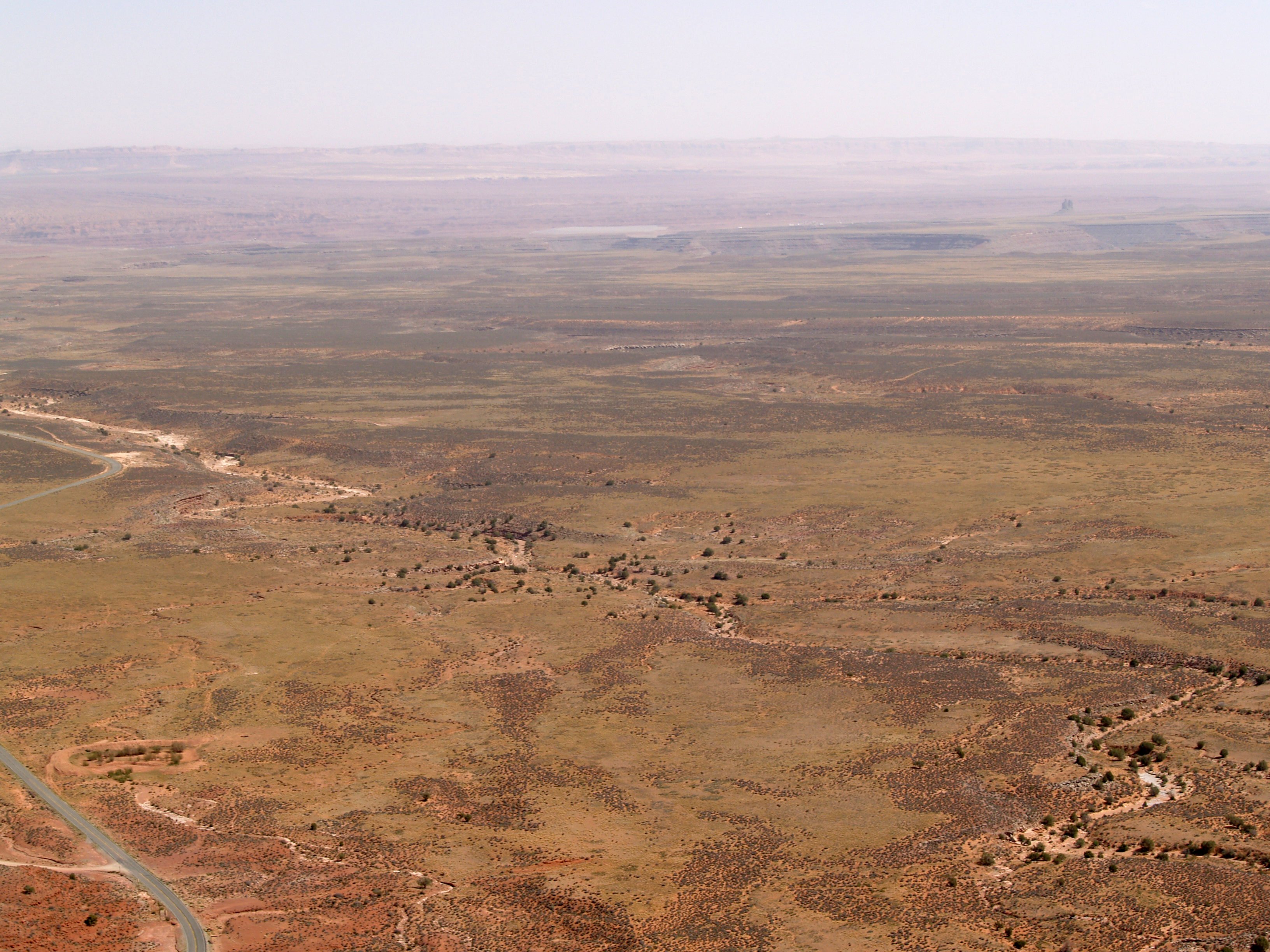
Photos 4241778 through 4241780 on April 24, 2006. |
 3 photo panorama of Newspaper Rock in Utah, April 24, 2006 Click here to see the rest of the photos of this area |

Panoramic Photo Pages Index
This site was last updated on October 6, 2014.
Panorama Photos Page 1 -
Arizona
Panorama Photos Page 2 -
California - Colorado - D.C. - Idaho - Montana - Nevada
Panorama Photos Page 3 -
New Mexico - Oklahoma - Oregon - Texas - Utah #1 (Misc.)
Panorama Photos Page 4 -
Utah #2 (Arches, Goblin Valley, Black Dragon)
Panorama Photos Page 5 -
Utah #3 (Dinosaur Nat. Mon., Mt. Nebo, Bryce)
Panorama Photos Page 6 -
Utah #4 (Zion, Misc.)
Panorama Photos Page 7 -
Washington - Wyoming - Guatemala: Tikal
Panorama Photos Page 8 -
Mexico: Edzna, Kabah, Sayil, Mitla, Mt. Alban, Palenque, Yaxchilan, and more
Panorama Photos Page 9 -
San Diego: Downtown - Various Buildings - Boats
Panorama Photos Page 10 -
San Diego: Mountains and Hills
Panorama Photos Page 11 -
San Diego: Golf Courses, Country Clubs and Parks
Panorama Photos Page 12 -
San Diego: Tijuana and the US-Mexico Border - Miscellaneous
Panorama Photos Page 13 -
San Diego: Bays and Lagoons - Lakes and Reservoirs
Panorama Photos Page 14 -
San Diego: Airplanes and Airports
Panorama Photos Page 15 -
San Diego: Schools and Museums
Panorama Photos Page 16 -
Miscellaneous or Unsorted
- - -
I also have over 3,600 panoramic photos from my 2016-2017 travels across the United States. Use this link to see them -
since September 4, 2005