I took all of of these pictures.
Click on a smaller pictures to see a larger version of it.

The waves crashing up on the rocks a few miles east of Cabo.

This is a panoramic view of Land's End from the bay looking west.
To the left
is Land's End. Cabo San Lucas is to the far right.

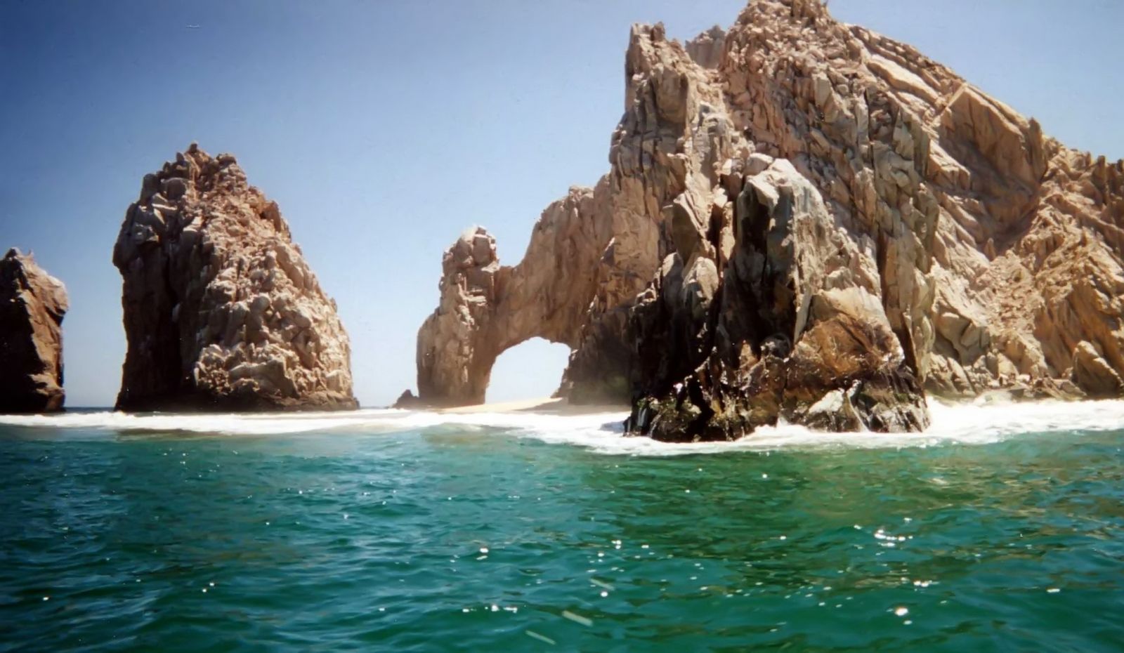
This is a close-up of "El Arco" (The Arch).

This is the eastern half of the bay at Cabo.
There is a US Navy vessel at
anchor in the bay.

Land's End from the Pacific side (looking east).
The sailing ship takes
tourists out for sunset cruises.

The Arch from the Pacific side.
The waves are bigger and stronger on the
Pacific side.

I took this picture while on a glass bottom boat.
The snorkeling & diving
is very good here.

El Arco, again, from the bay side.
The color of the water is quite striking.

More of the Land's End rocks.
Land's End is the southern most tip of the Baja
California peninsula.

Lover's Beach.
Water taxis will take you right up to the beach. This is the
only part of the Cape where the beach goes from the bay side to the Pacific side.

I went up in a Para-sail.
The unraveling material is only the cloth covering
on the metal framework of the parachute harness.

Another picture of the bay.
My boat has just crossed the wake of another boat.

You go up quite high.
It is also very quiet, and beautiful.

An aerial view of the bay.
Lover's Beach is to the left of center.

More rocks at Land's End.

I went out on a "Booze Cruise," (all you can drink).
Since I seldom drink,
I had the rum punch without the rum.
These are some of my unnamed co-conspirators.

More of Land's End from the para-sail.

Coming in for a landing.
My turn in the para-sail lasted for about 10 minutes.
I would have loved to stay up for a much longer time.
")
Looking west toward Land's End
")
From the coast road
")
I had to run to get this far away before the self timer worked.
")
Nice waves
")
The water is so nice looking
")
From the Pacific side
")
A small arch that goes all the way through
")
The roacky coastline along Land's End
")
The Pacific side
")
More roacky coastline

This looks like a cartoon face smiling

The cartoon silouette

Cove side
")
Pacific side
")
Yes, it is this blue, at times
")
An osprey
")
An osprey
Click Here To Return to Previous Website


since September 4, 2005


")
")
")
")
")
")
")
")
")
")


")
")
")
")
since September 4, 2005