Phil Konstantin's 2003 Vacation Through Washington, Idaho, Wyoming, Nebraska, South Dakota, North Dakota and Montana

Page 2003 - W
Cree Crossing to Fort Assiniboine
Click on the smaller pictures to see a larger version of it.


Cree Crossing is near Hinsdale, along Montana's "Hi-Line".
This is what they call Highway 2 which travels along the northern part of the state.


Sleeping Buffalo Rock...


Not having seen many sleeping buffalos,
I cannot say if that is what these rocks look like...


Welcome to the Fort Belknap Reservation.


The Vision Quest sign is located east of Harlem, Montana.


My co-speaker at the conference (George Horse Capture) said this park was named for his grandfather.


The approaches to Bear Paw Battlefield (south of Chinook, Montana).


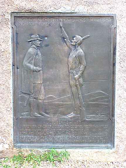
The location of Nez Perce's final battle with the army.

This plaque says: "October 5, 1877 - Surrender of Chief Joseph to Colonel Nelson A. Miles, to the valor and devotion of those both red and white who struggled here."


Another marker...


The follow Nez Perce were known to have been killed in this battle:    Eagle Necklace, Sr., Heyoomeekahlikt (Grizzly Bear on His Back), Kowwaspo, Koyehknown, Lakoyee, Looking Glass, Lying, Ollokot, Peopeo Ipsewahk (Lone Bird), Red Legs, Young Sookoups, Timlihpoosman, Tohtohaliken, Toohoolhoolzote and Wawookya Wasaaw (Lean Elk or Poker Joe).   About a dozen more Nez Perce were also believed to have been killed in the fighting here.  


A map showing the path the Nez Perce took on their flight from the army in 1877.

Click here to see a very detailed NPS map of the Nez Perce Trail


This Map shows the reservations in the area and the traditional Nez Perce lands.


This marks where John Dog's Tepee was erected.


This is the area where the Nez Perce made camp before the battle.
They did not know the army was so close.


The depression in the bottom center of this picture is where one of their lodges was placed.


Chief White Bird stayed here...


This is where some of the rifle pits were dug.


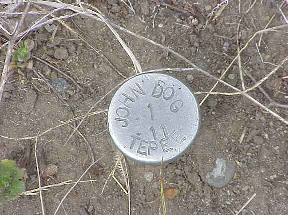
This is where Looking Glass was killed. You can see some of the offerings which have been left here.


According to this plaque, Ollokot fell here...more offerings...


More of the battlegrounds...you can see the visitor's area (a bathroom and the markers) in the distance. There is no visitor's center.


This marks where Chief Joseph surrendered and said,"From where the sun now stands, I will fight no more, forever."


Roughly 44 miles from the Canadian border, this is where the Chief surrendered on October 5, 1877 at 2pm.


Fort Assiniboine marker, near Havre, Montana.

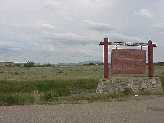
A look at the area around the fort.

The sun a few hours before sunset near the Rocky Boy (Stone Child) Reservation.

Click here to return to my main page
Click here to go to the previous page (Fort Union to Old Fort Peck)
Click here to go to the next page (Glacier Park)
or
Click on the underlined page number to go to that page directly.


Page 2003: Spokane, Washington to Grangeville, Idaho Page 2003a: Grangeville, Idaho to Kamiah, Idaho Page 2003b: Kamiah to Lolo Pass Page 2003c: Lolo, Montana to Salmon, IdahoPage
Page 2003d: Salmon, Idaho to Gilmore Summit, Idaho Page 2003e: Kilgore, Idaho to Yellowstone National Park Page 2003f: More Yellowstone Page 2003g: Grand Tetons to Lander, Wyoming
Page 2003h: Wind River Canyon to Legend Rock, Wyoming Page 2003i: Medicine Lodge State Archaeological Site to Red Gulch Dinosaur Tracksite, Wyoming Page 2003j: Shell Creek Falls to Wagon Box Battlefield, Wyoming Page 2003k: Rosebud Battlefield to Little Bighorn Battlefield, Montana
Page 2003l: Little Bighorn Battlefield to Crow Agency, Montana Page 2003m: Fetterman Battlfield to Fort Phil Kearny, Wyoming Page 2003n :Crazy Woman Creek to Fort Fetterman, Wyoming Page 2003o: Oregon Trail to Fort Laramie, Wyoming
Page 2003p: Grattan Battlefield, Wyoming to Fort Robinson, Nebraska Page 2003q: Hudson-Meng Bison Bonebed, Nebraska to Crazy Horse Monument, South Dakota Page 2003r :Devil's Tower, Wyoming Page 2003s: Rapid City to Badlands National Park, South Dakota
Page 2003t: Eagle Butte Powwow to the Blessing Ceremony Page 2003u: Sakakawea Monument to Fort Buford Page 2003v: Fort Union to Old Fort Peck Page 2003w: Cree Crossing to Fort Assiniboine
Page 2003x: Glacier Park#1 Page 2003y: Glacier #2 to Missoula, Montana Page 2003z:blank (so far) Home Page


Google
 
Web americanindian.net


Click on the drop down menu:

or
Click on the image below to go to......

My website's home page My Website's Home Page My main links page with connections to thousands of other websites Links: (8,700 and counting) my page with tribal name meanings & alternate tribal names Tribal Names
Indian tribal moon names & other calendar information Indian Moons My personal photos Personal Photos My biography My Biography
What happened to a sleepy driver Sleepy Driver My website about NASA & the Space Program The Space Program photos & info of my trip to some ancient ruins in Mexico & Guatemala Ancient Ruins in Central America
photos & info on my trip to some ancient Maya ruins in 2000 Maya Ruins in Mexico My late wife Robyn's page about whales & whale watching Whales Awards this site has received & WebRings to which this site belongs Awards & Webrings
photos & descriptions of the 2001 Cherokee National Holiday in Tahlequah, Oklahoma Cherokee Holiday 2001 a page with basic info for the Cherokee Nation (Oklahoma) Cherokee Enrollment an archive of my past monthly newsletters My Newsletters
places where you can shop to support this site My Store a page about the California Highway Patrol California Highway Patrol locations of 'Indian Era' forts Indian Era Forts
copies of articles I have written Articles I Wrote photos of northwestern USA historical sites & reservations Northwestern USA Indian Country photos of the opening of the National Museum Of The American Indian in Washington, D.C. ( 2004) American Indian Museum in D.C. 2004
reviews of Movies, Books and other things... Movie & Book Reviews photos an info about the guests and happenings at KUSI TV in San Diego KUSI TV, my other job photos of Mesa Verde and Utah in 2006 Mesa Verde and Utah in 2006
My mortgage loan compnay My Mortgage Loan Company photos of the 2006 SDSU powwow 2006 SDSU Powwow photos of mostly California beaches Beach Photos


(© copyright 1996-2008)